National

Collaborating across sectors to deliver vital ocean data and tools that serve coastal communities, protect ecosystems, and inform national decision-making.

Connecting Local Expertise to Global Ocean Science

The U.S. Integrated Ocean Observing System (IOOS) is a nationwide partnership that includes 17 federal agencies and 11 regional associations (RAs).

Additional partners include industry, academia, state, local, and tribal governments, and other federal and non-federal organizations.
Federal Agencies
0
Regional Associations
0
Industry Partners
0 +
Collaborators
0 +

Industry Partners

Innovative technology partners delivering cutting-edge ocean observation solutions
Technology

High Frequency Radar

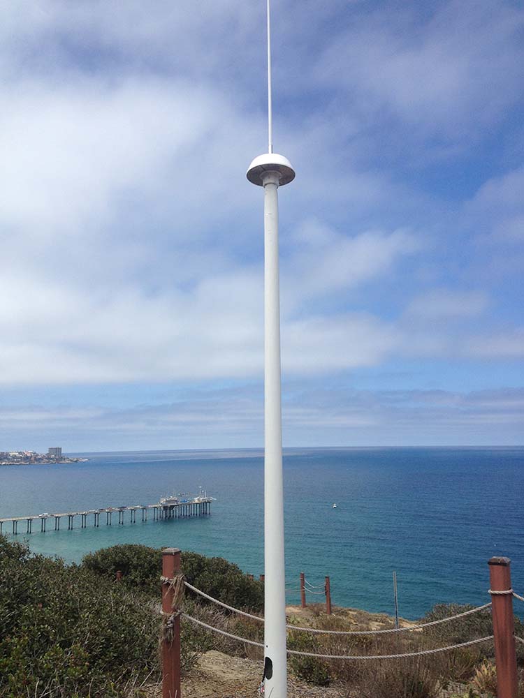
A significant part of IOOS’ mission is to establish and maintain a national HF-Radar network delivering surface current and wave data.

These measurements support NOAA’s Office of Coast Survey, CO-OPS Tides & Currents, and Weather Forecasting Offices.

Key Partner:

CODAR Ocean Sensors has built about 80% of HF radars globally.
The Scarlet Knight, first underwater robot to make a transatlantic crossing.
Innovation

Profiling Gliders

Critical tools for collecting ocean data in dangerous or remote environments.

Historic Achievement:

In 2009, MARACOOS flew the first glider across the Atlantic from Rutgers University to Baiona, Spain.
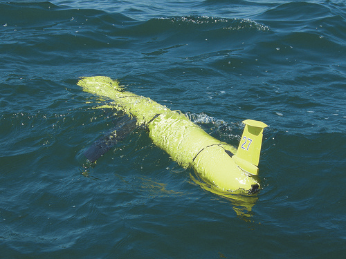
Liquid Robotics Subsea Wave Glider at work.
Sustainable Tech

Wave Gliders

Wave gliders harness energy from waves and sunlight to collect ocean data without fuel or ship support.

Hurricane Research:

In 2015, GCOOS, NOAA, and Liquid Robotics deployed wave gliders into Gulf hurricanes to test durability.

Value-Added Companies

Companies leveraging IOOS data to deliver specialized forecasting and analytical services

Surfline

Provides surf forecasts, FishTrack for fishing enthusiasts, and BuoyWeather offering marine forecasts via virtual buoys worldwide.

WeatherFlow, Inc.

Integrates IOOS data into custom weather modeling and provides accurate forecasts tailored for specific industries.

ROFFS

Combines satellite and fisheries data to deliver forecasts for commercial fishing, oil and gas, ship routing, aquaculture, and research.

Programs

Collaborative initiatives supporting ocean observation and environmental protection

National System of Marine Protected Areas

MPAs rely on IOOS data for monitoring and serve as testbeds for new ocean observing technologies.

National Water Quality Monitoring Network

Links inland and coastal data to support water protection, combining biological, chemical, and physical indicators across agencies.

U.S. Group on Earth Observations

Coordinates Earth observation strategy for the U.S., co-chaired by OSTP, NOAA, and NASA. Supports international systems like GEOSS.

Key Documents

Strategic plans and operational blueprints guiding IOOS initiatives

U.S. IOOS Blueprint for Full Capability

Comprehensive strategic framework for achieving full operational capability

National Operational Wave Observation Plan

Strategic plan for nationwide wave observation infrastructure

National Surface Current Mapping Plan

Comprehensive approach to surface current observation and mapping

Federal Agency Partners

17 federal agencies collaborating to advance ocean observation capabilities

NOAA

NSF

NASA

EPA

BOEM/BSEE

MMC

ONR

Oceanographer of the Navy

USACE

USCG

USGS

USDA CSREES

DOE

Department of State

DOT

FDA

USARC

Search the Site