Access IOOS Data

Connect to real-time and historical ocean observations, predictive models, and environmental datasets from across the U.S. Integrated Ocean Observing System network.

IOOS.us National Data Portal

The IOOS.us National Data Portal connects users to data collected by the U.S. Integrated Ocean Observing System. The portal features information from a wide range of sources including buoys, radar systems, and gliders. Modeling teams across IOOS regional associations contribute predictive models and environmental datasets that support ocean and coastal observations.

Users can explore data through interactive maps, Regional Association portals, and IOOS Data Assembly Centers (DACs). The portal also includes demonstrations and examples for scientists and managers who want to use IOOS data in programming languages like Python, Matlab, and R.

IOOS Data Products

Explore our suite of specialized tools and platforms for accessing, visualizing, and analyzing ocean observing data.

The IOOS Catalog

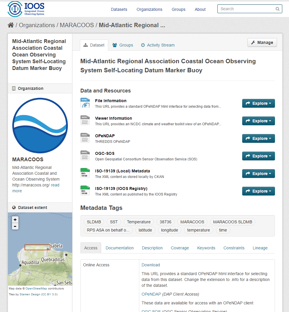
The IOOS Data Catalog is the master inventory of IOOS DMAC datasets and data access services. Users of the Catalog can do a plain text search to locate datasets of interest across the regions, and then connect to their associated data access services in their application of choice. The Catalog is powered by metadata, and allows users the ability to search for words or phrases within the metadata (eg. salinity observations) to locate relevant datasets. IOOS provides a number of data access service types, including Sensor Observation Service (SOS), OPeNDAP for gridded data and model output, and Open Geospatial Consortium WMS and WCS for use in GIS applications. Catalog users may vary in background and familiarity with the IOOS data access services; power users such as scientists, geospatial data analysts, or environmental managers may get the most from the Catalog, however tools to enable the casual user to visualize IOOS data from these services conveniently from within the Catalog are in the works.

Environmental Sensor Map

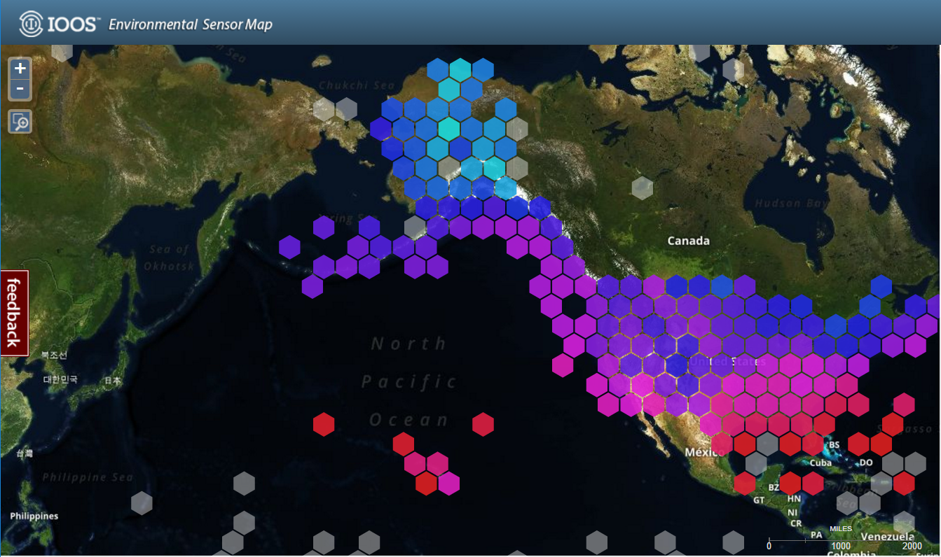
The Environmental Sensor Map integrates regional, national, and global real-time (past 4-hours) data across the IOOS enterprise. Data from observing systems operated by IOOS Regional Associations and local data providers within these regional footprints can be viewed and downloaded through this map. The map connects to over 32,000 stations providing the latest information on oceanographic and meteorological conditions. Individual stations and sensors can be selected when zoomed in. Data is obtained through various SOS access points. Dynamic graphs provide overview statistics for individual sensors or regions. The primary users of this map include Federal, State, and local marine scientists, coastal resource managers, and the general public.

IOOS Model Viewer

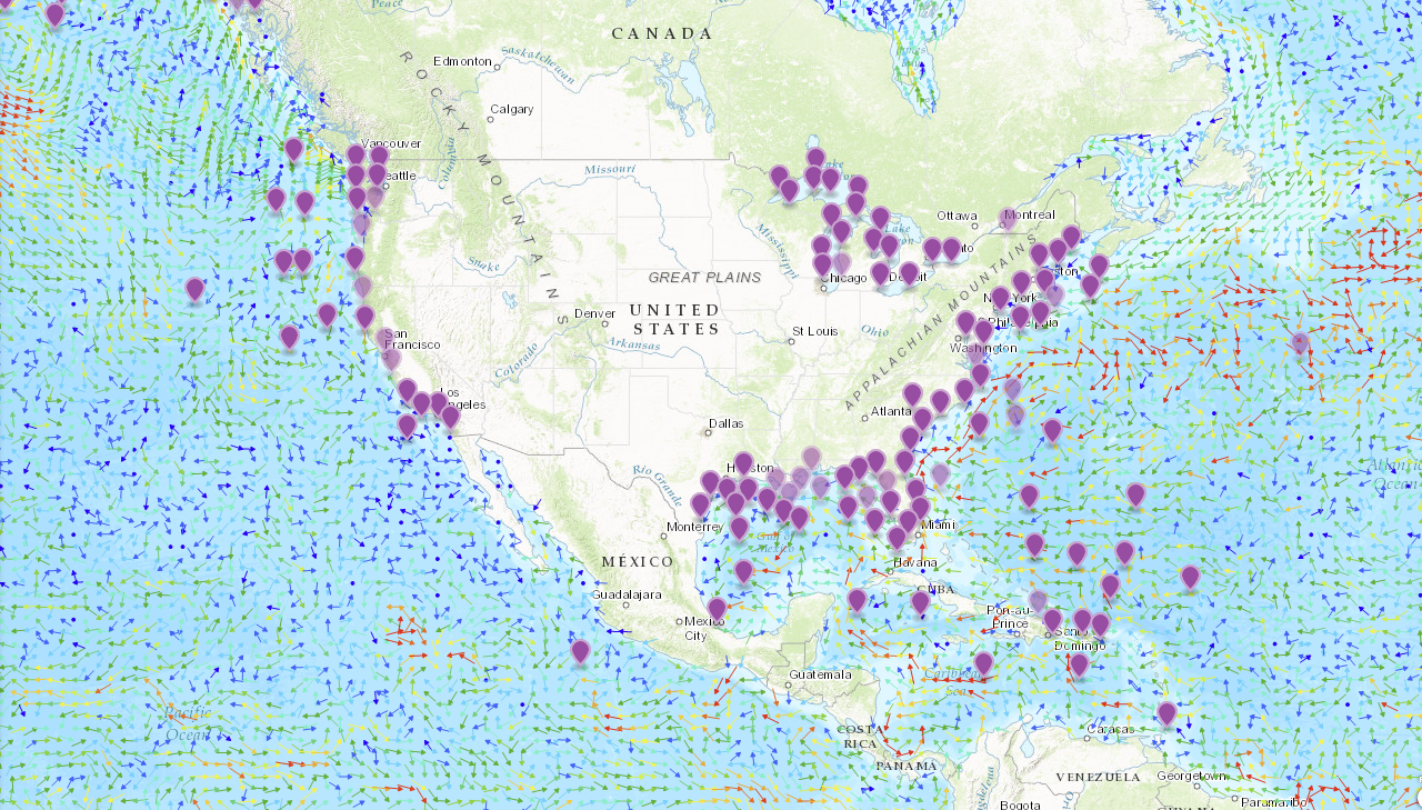
The IOOS Model Viewer provides a platform for visualization and analysis of integrated model output. Users can examine several modeled variables together in a map-based environment, and generate time-series plots of the output. Real-time observations are also available for comparison purposes. The engine driving this visualization is the Environmental Data Server (EDS), which harvests model output from a variety of disparate sources and normalizes the output into a single format: CF-compliant NetCDF. The EDS also provides data access services through a THREDDS server, which is available through the Viewer. This product is intended for use by the marine user community, though is open for exploration by the interested public.

Animal Telemetry Network Data Portal

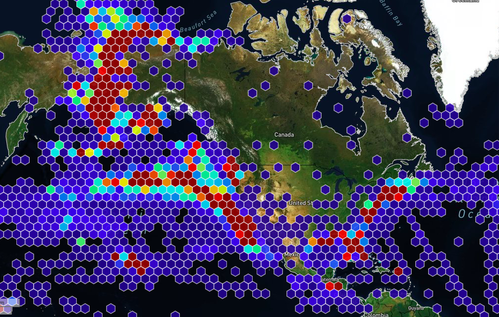
The ATN data management vision includes a regionally distributed data collection, management and sharing capacity that builds on and integrates as many existing telemetry data links as possible to enable local and regional needs to be addressed. At the heart of this system is a centralized data assembly center (DAC) operated by Axiom Data Science. This DAC is a community resource where U.S animal telemetry data is aggregated in a single place where visualization of and access to the data is provided via the ATN Data Portal.

Data Assembly Centers

Specialized hubs that aggregate, standardize, and distribute specific types of ocean observing data for national and global use.

High Frequency Radar DAC

The HF-radar network delivers surface current and wave data from U.S. waters to users nationwide and supports critical weather and marine forecasting operations at NOAA’s Office of Coast Survey, CO-OPS Tides & Currents, and Weather Forecasting Offices throughout the country. The HF-radar DAC offers access to near-real time data as hourly or 25-hour averaged surface currents on an interactive map. Scientists can also gain access to historical and near-real time data as NetCDF files on-demand via NDBC. Depending on the frequency range of the coastal stations, data are collected at a resolution ranging from 500 m to 6 km.

IOOS Underwater Glider DAC

The mission of the Glider DAC is to provide glider operators with a simple process for submitting glider data sets to a centralized location, enabling the data to be visualized, analyzed, widely distributed via existing web services and the Global Telecommunications System (GTS) and archived at the National Centers for Environmental Information (NCEI).

Animal Telemetry Network DAC

The ATN DAC is a centralized data assembly center to enable seamless data ingestion, storage, access and redistribution of U.S. national animal telemetry data and products. Once fully developed, the DAC will provide operational national capacity for secure and sustainable data management and display of marine animal telemetry data, as well as a data portal serving the public via U.S. IOOS standard services such as NOAA’s Environmental Research Division’s Data Access Program (ERDDAP), Sensor Observation Service (SOS), or Web Map Services through OPeNDAP protocol. This DAC is designed to address the needs of Federal, State, and local marine scientists, coastal resource managers but the general public is welcome to explore the interactive features of this site.

Regional Data Portals

The IOOS Regional Associations each maintain a data portal tailored to their specific region. These portals provide access to real-time and historical ocean, coastal, and Great Lakes data to support safety, operations, and environmental understanding.

AOOS

Alaska Ocean Observing System

CariCOOS

Caribbean Coastal Ocean Observing System

CeNCOOS

Central & Northern California OOS

GCOOS

Gulf of America OOS

GLOS

Great Lakes Observing System

MARACOOS

Mid-Atlantic ROOOS

NANOOS

Northwest A-NOOS

NERACOOS

Northeast ROOOS

PacIOOS

Pacific Islands OOS

SCCOOS

SoCal Coastal OOS

SECOORA

Southeast COORA

Mobile Data Tools

Mobile-friendly websites and applications from IOOS Regional Associations and partners.

CARICOOS Mobile Apps

Android
Real-Time Data
The Caribbean Coastal Ocean Observing System (CariCOOS) mobile app provides real-time ocean and weather data for the Caribbean region. Access wave heights, water temperature, wind conditions, and weather forecasts essential for maritime operations and coastal activities.
Provider: Caribbean Coastal Ocean Observing System

NANOOS NVS Data Explorer

Web
Pacific Northwest
The NVS Assets App provides easy access to data on-the-go in the field or on the water. It displays data from federal, tribal, state, academic, industry, and non-profit organizations, who operate a wide variety of observing assets including buoys, shore stations, sea-bed, and coastal land-based stations. This composite view provides a comprehensive view of ocean conditions.

Provider: Northwest Association of Networked Ocean Observing Systems

Data Explorer App and Tsunami Evacuation App (provided by NANOOS)

Android
iOS
Emergency Preparedness
TsunamiEvac-NW provides at-a-glance view of where the tsunami hazard zones are along the Oregon and Washington coast, and allows to map whether your home, work, school, etc. is located in a tsunami evacuation zone or not. To help develop and plan evacuation routes, TsunamiEvac-NW enables to save user’s current position or points of interest via GPS or address look-up.
Provider: Northwest Association of Networked Ocean Observing Systems

PacIOOS Voyager Mobile

Web
On-Demand
The PacIOOS Voyager is a free, interactive, online mapping experience on the familiar Google Maps platform. View, combine, and download current or historical oceanographic observations, predictions, and other geospatial information related to the marine environment and beyond.
Provider: Pacific Islands Ocean Observing System

NOAA CBIBS (Smart Buoys)

iOS
Buoy Data
The CBIBS “smart buoys” collect and transmit real-time weather and water data. CBIBS supports the use and management of a healthy Chesapeake Bay by providing the data and information needed to improve safety, enhance the economy, and protect the environment.
Provider: NOAA Chesapeake Bay Interpretive Buoy System

Mobile Websites and Apps from NOAA's National Ocean Service (NOS)

iOS
Android
Multi-Tool Suite
A compilation of ocean and coast-related mobile websites and free applications produced by or in partnership with National Oceanic and Atmospheric Administration, NOAA.
Provider: National Oceanic and Atmospheric Administration

Resources

Tools, tutorials, and documentation to help you work with IOOS data effectively.

IOOS CodeLab

The IOOS CodeLab is a data usage blog designed as a technical resource for marine scientists. This site offers readers a suite of tutorials and examples to acquire and work with IOOS technologies and data sources. The blog offers Jupyter Notebook examples of Python, Matlab, and R code to access, analyze or display various IOOS data. Some posts are basic examples of code using IOOS data or products, others are more technical, offering demonstrations of new code packages or analysis techniques that community members have developed. The authors of these blog posts include both members of the IOOS program office staff and invited RA or partner scientists within the IOOS community. On this blog scientists can also find links to RA data portal video tutorials and other video presentations made by IOOS partners.

Additional Resources

IOOS Systems & Software

Learn more about IOOS systems and software development.

THREDDS Quick Start

Get started with THREDDS server from Ocean Observatories Initiative.

ERDDAP Quick Start with Docker

Deploy an ERDDAP server using Docker and IOOS example datasets.

NOAA Metadata Guidance

Official metadata standards and guidance from NCEI.

Search the Site